
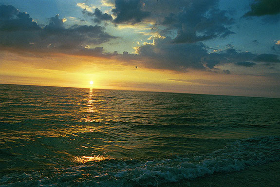
Dead zones begin when rivers carry nitrogen and phosphorus from agricultural fertilizers into the ocean. The Mississippi River delivers these “nutrients” from the American heartland into the Gulf of Mexico at a rate of 1.7 million tons per year. (Photo: Flickr.)
By Paul Greenberg
The Food and Environment Reporting Network
Since the 1970s, an oxygen-deprived “dead zone” often bigger than the state of Connecticut has formed every summer in the Gulf of Mexico. Nancy Rabalais, the executive director of the Louisiana Universities Marine Consortium and the dead zone’s leading researcher, likens the phenomenon to “stretching a sheet of plastic wrap from the mouth of the Mississippi River west to Galveston Texas and sucking out all the air.” This year, that sucking sound may be particularly loud because the National Oceanic and Atmospheric Administration is predicting a larger-than-usual dead zone.
Dead zones begin when rivers carry nitrogen and phosphorus from agricultural fertilizers into the ocean. The Mississippi River delivers these “nutrients” from the American heartland into the Gulf at a rate of 1.7 million tons per year.
When this stew of nutrients reaches the ocean, it causes algae to bloom in prodigious amounts. As the algae dies and settles to the bottom, bacteria consume it, pulling oxygen from the water. This suffocation takes place atop the most important commercial fishing grounds in the continental United States, suggesting that the nation is sacrificing publicly owned seafood for the sake of privately produced land food.
But unlike other seemingly intractable environmental problems, dead zones can be fixed. Part of the solution might be found near the Civil War battleground city of Vicksburg, Mississippi, with Paul Hartfield, a biologist with the U.S. Fish and Wildlife Service.
“Once upon a time,” Hartfield said as he steered down the Mississippi in a salvaged aluminum skiff, “we had a floodplain that was over 100 miles wide. Now along most of the river it’s probably not more than five.”
In the past, the river regularly overflowed its banks, spreading across the vast flood plain. The current slowed, nutrient-laden sediment settled out, and the water became clear enough for sunlight to penetrate. This allowed photosynthetic algae to bloom and process nitrates and phosphates. As a result, a significant part of the nutrients coming down the river were consumed before reaching the Gulf of Mexico. Decisions made 150 years ago, though, largely destroyed all that.
The Mississippi has been called “the most engineered river on the planet,” and the reason it was engineered to such an extent was so that farmers could gain access to the tremendously fertile floodplain. As early as 1857, a geologist predicted that if the river could be contained and the floodplain secured, the Mississippi Valley would become “the central point—the garden spot of the North American continent—where wealth and prosperity culminate.”
This came to pass. Levees sprouted from Illinois to the river’s terminus at Port Eads. But in Hartfield’s opinion, one of the most radical changes made to the lower river was its transformation from a lazy wandering affair into a straight line. Starting in the 1930s, the Army Corps of Engineers systematically lopped off 16 large bends, shortening the river by 150 miles.
Floods were indeed reduced, but afterward the lower Mississippi changed from a complex marshy wetland into a fire hose that blasted nitrogen and phosphorus straight into the Gulf. It is this fire hose that Hartfield hopes to adjust.
Heading upstream across the broad muddy river, Hartfield spoke about his long-standing negotiations with the Corps. “The Corps are focused on what’s out here,” he said, indicating the main part of the river where government engineers try to maintain a safe and efficient navigable channel. At a turn-off, he veered his skiff to the left. “Me, I’m focused on what’s in here.”
In a little while, he navigated into a different habitat he calls a “backswamp.” Carefully, he guided the boat through an eerie forest of half-submerged trees. A pair of green and red navigation buoys and other random refuse, flushed from upstream, bobbed by. “This is a peaceful spot to contemplate the dissolution of the elements,” Hartfield mused.
What Hartfield envisions is a series of little fixes on the model of this quiet little patch of backswamp. He has been working with the Corps to create modest redirections of current that do not affect navigation or flood control, but that move more water into floodplain channels and swamps. “These small local modifications,” he said, “can be constructed during routine maintenance and construction activities, at no extra cost to the taxpayer.”
The swamp’s impact on water quality is immediately visible. On the upstream side of the backswamp, several miles away, the water entering the floodplain was milk-chocolate brown, rife with all the sediments and nutrients the river holds. On the downstream side, water flowed out of the vegetation almost translucent with the deep green color of living algae luxuriating in a liquid feast.
“All the leaves and stems of the vegetation growing in the swamp slow that water down, and the sediment drops out,” Hartfield said. “When the water clears and sunlight gets in, the algae blooms and consumes the nitrogen and phosphorus in the water. Really, when you think about it, a floodplain is a river’s kidney.”
But the river’s wetlands—its kidneys—are failing, and it needs some kind of dialysis to set things straight. This is one of those points where naturalists like Hartfield usually end up banging their heads against the government bureaucracy the rest of their careers. But Hartfield allows himself to imagine the river of the future—a river where backswamps abound. So what he would do if by some miracle he could have all the money in the world?
“If I had all the money in the world? Hmm . . .” he said smiling and peering downstream. “I’d move the levees back five miles, then turn it all into a park from Cairo, Illinois, to Baton Rouge, Louisiana. Then I’d leave it alone and let the river fix itself.”
This article was produced by The Food and Environment Reporting Network, an independent, non-profit journalism organization in collaboration with The American Prospect. For a longer article on the full range of solutions to the Gulf of Mexico dead zone, see The Prospect.